Punta Levanto (trail 662) We never figured out the number system but there's probably a map out there that has them all listed. Anyway the trail went up and headed back towards Levanto.
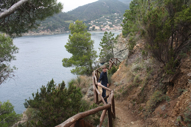
I'll say right away that the rail to trail was easy this trail was not. It was a rocky and root covered trail that went steadily up along the coast. Thank goodness there was a nice handrail between us and the rocks and water below!
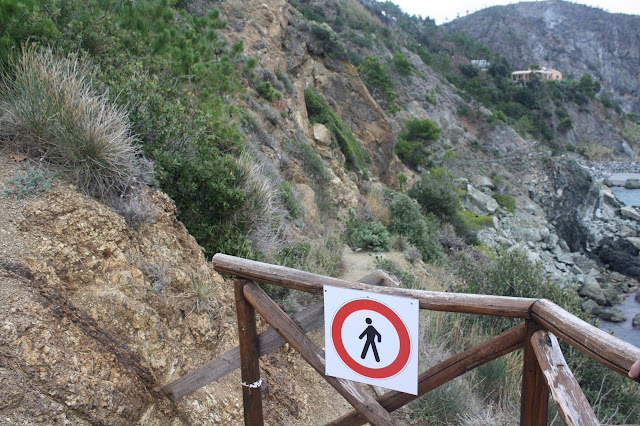
This is the end of the trail! It actually continues on the other side of the rock slide but we heeded the warning and stopped here!
Looking at Bonassola
It took us about 40 minutes to hike to the top or tip of the trail. We did make a few stops along the way to take pictures and catch our breath.
Directions and Tips:
Leave Levanto on the well marked walking/biking trail. As you come out of the last tunnel and reach the outskirts of Bonassola you'll see a small area on your left that has a bench and a trail marker. The marker says Punta Levanto 662. Take the trail. There will be a sign marking the top that says Bonassola with an arrow pointing back the way you came. You can't get lost! I doubt that the path will be cleared to go any further but if it is you'll probably end up back in Levanto.
- Hiking boots and a walking stick would probably be helpful although we had neither and managed just fine.
- Bring water
- There are no bathrooms on the trail but there are a few secluded spots in an emergency.
- Take your time and enjoy the views.
Don't be afraid to get off the main path and discover somewhere new!


No comments:
Post a Comment
Thanks for stopping by! I love to hear from you. I respond to every comment and I'll stop by your blog for a visit as well and will leave a comment for you.